- Join
- Aug 16, 2019
- Messages
- 898
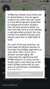
At the suggestion of seasoned Spark veterans on this site, one of the first apps I acquired was for AirMap. It appeared to have everything the fledgling UAV operator would need to operate in the airspace. Yesterday I was updating numerous apps, especially those I don't use on a very regular basis, and was greeted with unexpected shutdown news. I've not used LAANC system, but AirMap said they'd already disabled it for requesting authorization to fly in controlled airspace.
I remember AirMap was one of the entities that was jockeying for a place among contractors in the proposed system the FAA originally floated for requiring internet connection to be able to fly. Since the FAA wisely backed away from that system, it may be AirMap didn't see any profit in continuing to support the largely civilian UAS operations. Who knows, but anyway they are only days away from pulling the plug.
Any of our knowledgeable readers have suggestions for an app that will fill the gap?
Btw: Happy Father's Day!


